Day 4: Lyons to Baldwinsville
Saturday, August 7, 1999
We slept comfortably in our different surroundings
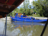
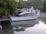 |
Ben's boat. |
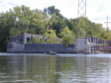
At Millers Marine, we saw the remnants of an aqueduct across the Ganargua
Creek. That was the same creek across which we had seen another aqueduct
earlier just after meeting Dave and Barbara.
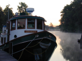 |
Charity in the morning. Lock 27 in the background. | |
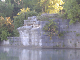 |
Aqueduct near Millers Marine. This used to have five arches. |
|
We traveled about fifty miles this day, from 7:00 a.m. to 5:20 p.m., without
getting off the steamboat.
Lock 27 (lift 12.5 feet) at Lyons was just downstream of the marina,
so we had to wait until it opened. We locked through about 7:20 a.m.
It was a beautiful day.
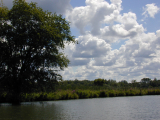
We traveled along the canalized Clyde River for a while. The original
river would meander on one side or the other of the canal, while our route
would be straighter.
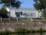 |
Three-paneled mural at the Southside Canal Park in Lyons. | |
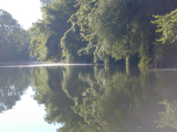 |
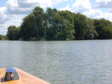
Peaceful canal. |
|
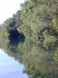 |
Reflections. | |
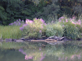 |
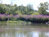
Purple loosestrife and driftwood. |
|
We had descended through Lock 26 (lift 6.0 feet) at Clyde and Lock 25 (lift
6.0 feet) at Mays Point by early afternoon and decided to go all the way
to Baldwinsville, rather than stop at the Weedsport Terminal Wall as we
had originally planned. We decided to make it a long day while we
had good weather, especially because the next day was not supposed to be
so good.
It continued to amaze us how remote we felt on the canal. We traveled
through a long stretch with few locks.
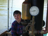 |
Al, the whistle, stack, and pressure gauge. | |
 |
Clouds over the canal. |
|
We passed through the Montezuma National Wildlife Refuge. This area
has an incredibly large number of great blue herons.
Clintons Ditch didnt follow the route of the present day Barge Canal
for a distance east of here. It went around the southern end of Onondago
Lake, passing through the canal ports of Syracuse, De Witt, Chittenago,
and Wampsville, meeting up approximately with the Barge Canal near New
London.
Eventually we came to the junction with the Cayuga and Seneca Canal,
marked by a small sign. This is the route to Cayuga and Seneca Lakes.
Somewhat east of this junction, we picked up the canalized Seneca River.
 |
Tugboat tender. | |
 |
Cayuga and Seneca Canal. |
|
 |
The Richmond Aqueduct on the early Erie. The Richmond Aqueduct was 894.5 feet long and fifty feet wide inside. Thirty piers and two abutments of stone masonry supported the trough of timbers which carried the canal over the river. Thirty-one arches supported the towpath. | |
 |
Flowers and heron. |
|
As we got closer to Baldwinsville, we encountered many boats. In
the region from, say, Weedsport, to Bville, there were many small cottages
along the shoreline. Cross Lake was a popular destination and vacation
spot. Some inconsiderate boaters got too close and would follow along,
leaving large wakes for us to contend with.
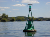 |
Buoy on Cross Lake. | |
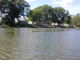 |
Cottages near Baldwinsville. |
|
We docked at the terminal wall in Bville, just above Lock 24 (lift 11.0
feet). We had left wood here in a storage shed by the lock. The lockmaster
said we could load the wood from the edge of the lock. So Al piled
the wood by the edge and we took the steamboat in. We loaded the
wood, then made an awkward U-turn and came back out of the lock It
was actually more like a multiple K-turn. This was done with the
upper gate open, so there were a lot of interested spectators.
As always, there were many people asking questions about the boat.
We ate dinner at the Lock 24 Seafood Dining Room overlooking the lock:
shrimp, hamburger, and salads. We also stopped at Eckerds to pick
up a few groceries.
The forecast was for rain overnight. Al put tarps along the sides
of the bed.
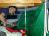 |
Al with tarp. |
Number of locks: 3
Approximate distance for day: 50 miles
Next day Previous
day Steamboat trip index